¶ Introduction
This article will show you what Webeye is and how you can use it for daily operation in IVAO.
¶ Overview
Webeye is the official interface for viewing online activity on the IVAO network.
 |
This interface has a graphical appearance showing:
- World Map
- Active Controllers
- Online Pilots
The Webeye is a WWW page accessible by using the link: https://webeye.ivao.aero/
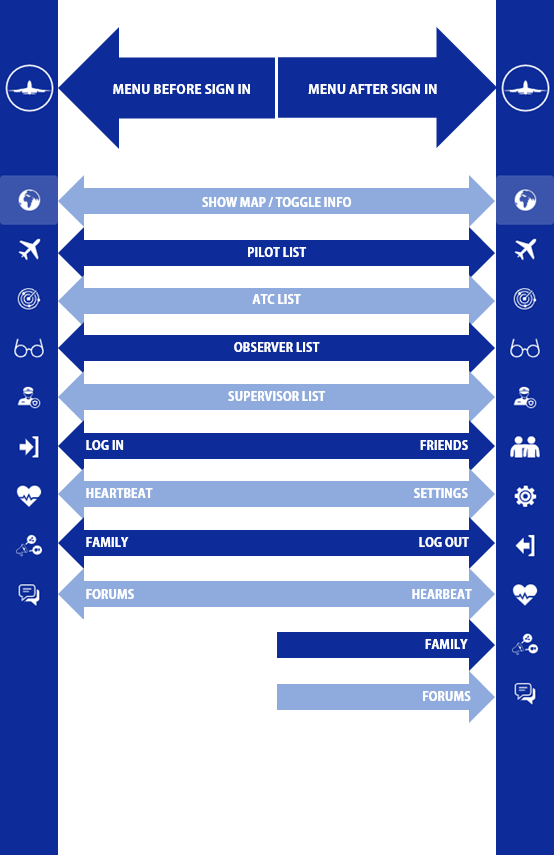
The Webeye interface has several menus on the left edge of the screen:
- Show map / Toggle info : Return to Map / Hide Info
- Pilots : List of online Pilots using table text.
- ATCs : List of online ATCs using table text.
- Observers : List of online Observers using table text.
- Supervisors : List of online Supervisors using table text.
- Friends (only visible when logged in) : List of your added friends using table text.
- Settings (only visible when logged in) : To configure display settings.
- Login / Logout : To log yourself by using your IVAO User ID.
- Heartbeat : Directs you to the Heartbeat website.
- Family : Directs you to the IVAO Family website.
- IVAO Forum : Directs you to the IVAO Forum.
¶ Settings
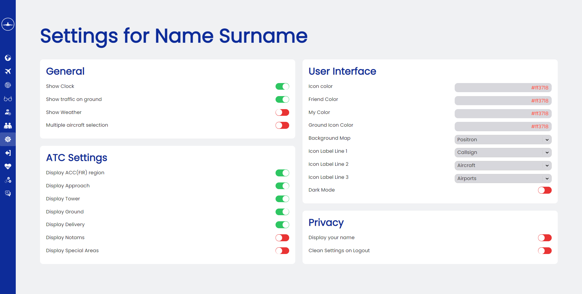
From the settings page, you can do various things to customize your Webeye experience.
Key Features:
- Dark Mode
- Background Map
- Show Weather
- Allow multiple aircraft selections
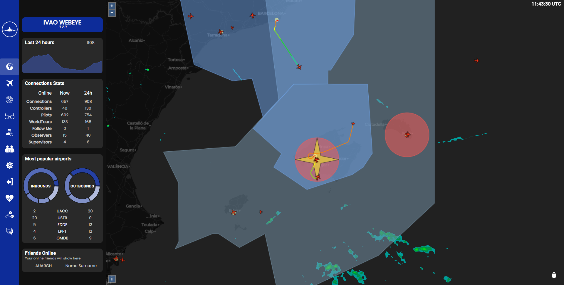
When you enable Dark Mode, sidebar color will change to black. Using Dark Mode with Background Map Dark Matter will make your experience even better. Here is an example:
¶ SIDEBAR
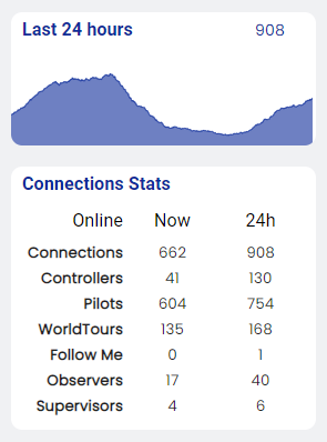
On the sidebar, you can find connection stats for the current moment and the peak 24 hours.
You can find the following information:
- Number of connections
- Number of active controllers
- Number of active pilots
- Number of active pilots flying World Tour
- Number of Follow Me vehicles
- Number of observers (including staff members)
- Number of supervisors
¶ Most Popular Airports
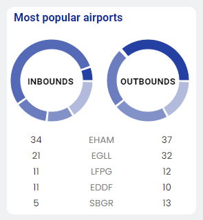
Below the Connections Stats, you can find the Most Popular Airports which has the most inbound/outbound traffics.
You can also hover your mouse over the pie chart to see details.
¶ Friends Online
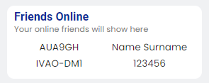
Below Most Popular Airports, you can see your friends list, by clicking on the callsign you can navigate to their Control Zone or aircraft.
Your friends are showed in a different color which you can choose through the settings. For ATC, you will see an outline with your preferred color.
¶ MAP DISPLAY
When you launch Webeye, you will find a world map with many aircraft icons on it and colored areas.
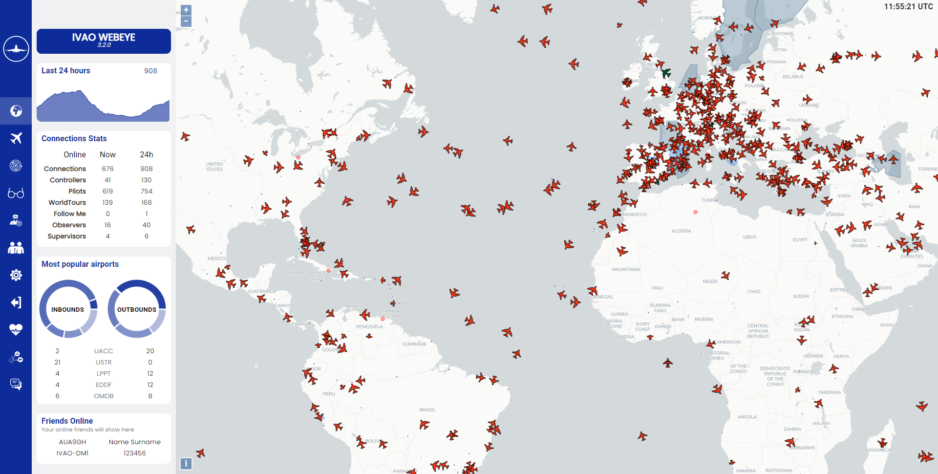
The Webeye interface will display above the map three types of IVAO activity:
- Pilot flying with aircraft or helicopter
- Air traffic controller in active control
- Ground Traffic including Follow Me if enabled in the settings
You can center the Webeye on a geographic point by using the following URL address:
Centering on geographic point: https://webeye.ivao.aero/?center=4.4;50.501&zoom=6
The first number is the number of degrees North(longitude), the second number is the number of degrees East(latitude), the third number is the zoom factor of this point.
You can center the Webeye on a callsign by using the following URL address:
Centering on pilot callsign : https://webeye.ivao.aero/?callsign=BAW123
Centering on ATC callsign : https://webeye.ivao.aero/?callsign=KJFK_APP
- center=longitude;latitude
- pilotId=VID
- callsign=callsign
- atcId=VID
- zoom=value
- airportId=ICAO
¶ ATC display on map
¶ AREA Controller (ICAO_CTR)
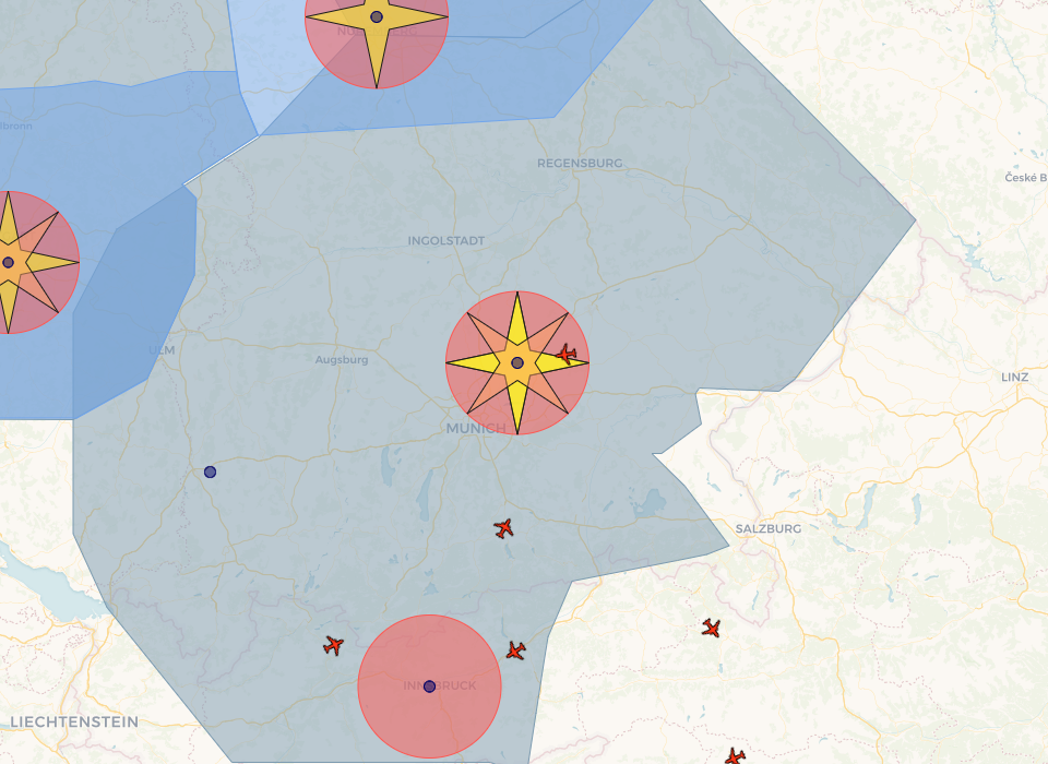
The area controllers or en-route controllers are represented by a large grey zone.This zone represents the exact lateral area of responsibility of the controller.
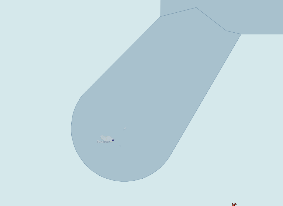
Keep in mind that the controller might not be responsible for each altitude vertically in this area.
¶ Military Control Zone
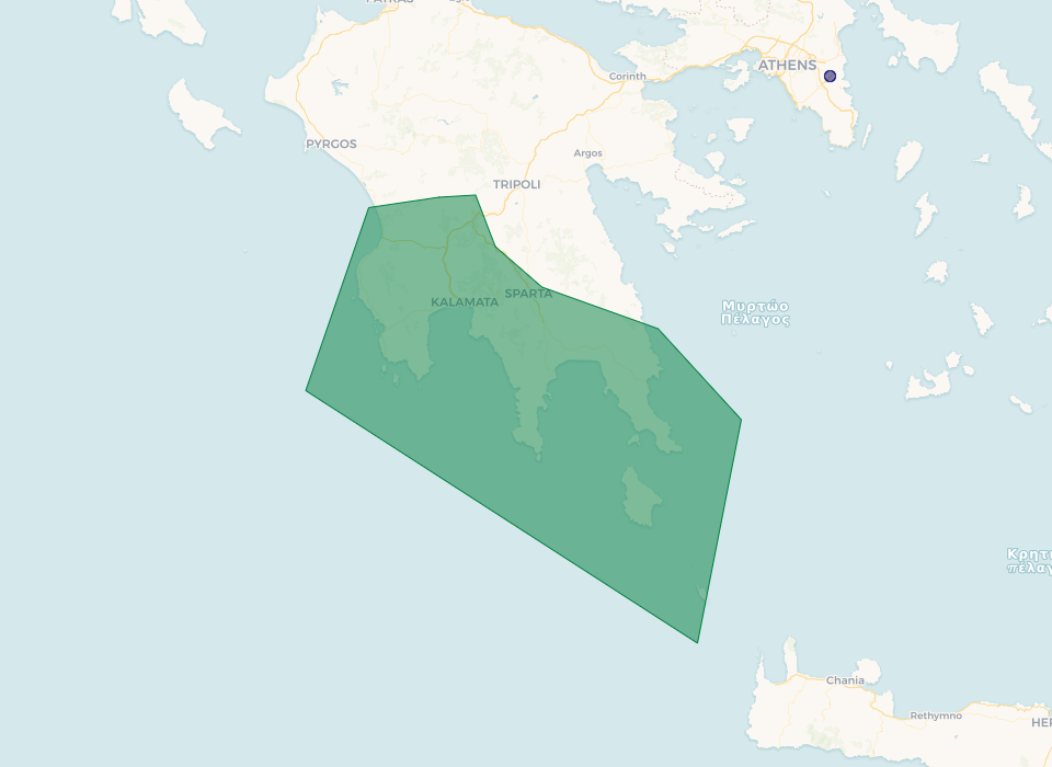
Military Control Zones are represented in green.
 |
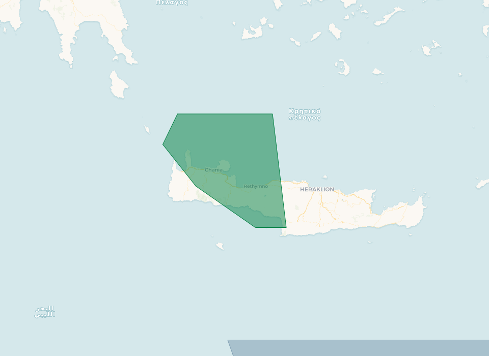 |
Be careful that sometimes the controller will not control vertically each altitude on this area.
¶ APPROACH or ARRIVAL Controller (ICAO_APP)
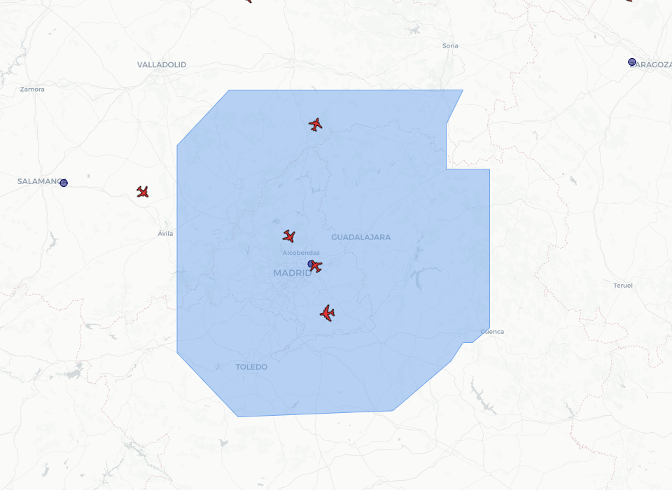
The approach and arrival controllers are represented by a blue zone.
 |
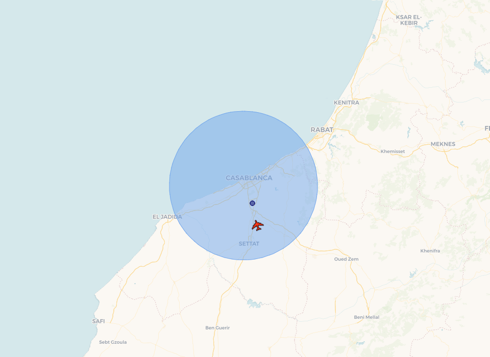 |
If this zone is a circle, it does never represent the exact area of responsibility of the controller. Usually this zone is larger than the depicted zone. As a pilot, your contact shall be anticipated.
If this zone is a shape (other than a circle), this represents the lateral limits of the TMA.
The approach controllers are not responsible for aircraft overflying at high level (usually greater than FL200) established at cruise flight level.
¶ DEPARTURE Controller (ICAO_DEP)
The departure controllers are represented by a pink rounded zone. This zone does never represent the exact area of responsibility of the controller. Usually this zone is larger than the depicted zone. As a pilot, your contact shall be anticipated.
The departure controllers are not responsible for aircraft overflying at high level (usually greater than FL200) established at cruise flight level.
¶ TOWER Controller (ICAO_TWR)
The tower controllers are represented by a small red rounded zone. This zone does not represent the area of responsibility of the controller, but in some cases it can represent the area of responsibility. If the shape is a circle, it might not represent the exact area of responsibility of the controller. Usually this zone is larger than the depicted zone. As a pilot, your contact shall be anticipated.
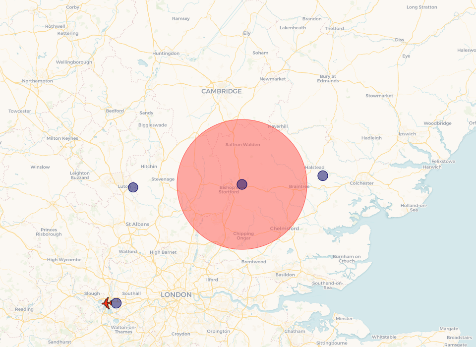
The tower controller is responsible for the runway and surrounding area.
¶ GROUND Controller (ICAO_GND)
The ground controllers are represented by yellow star shaped zones. This zone does not represent the area of responsibility of the controller.
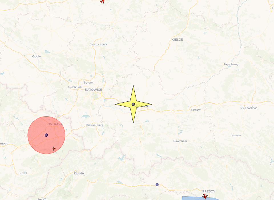
The ground controller is only responsible for the taxiways and aprons on this airfield. This could change within airports and countries.
¶ DELIVERY Controller (ICAO_DEL)
The delivery controllers are represented by orange star shaped zones. This orange zone does not represent the area of responsibility of the controller.
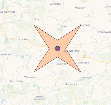
The delivery controller is responsible to issue departure clearance on the ground.
¶ Combined position
Several positions can be combined and you can find here under some examples of combined positions:
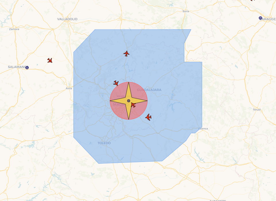
Tower (TWR) position combined with ground (GND) position
¶ Special Area Display on Map
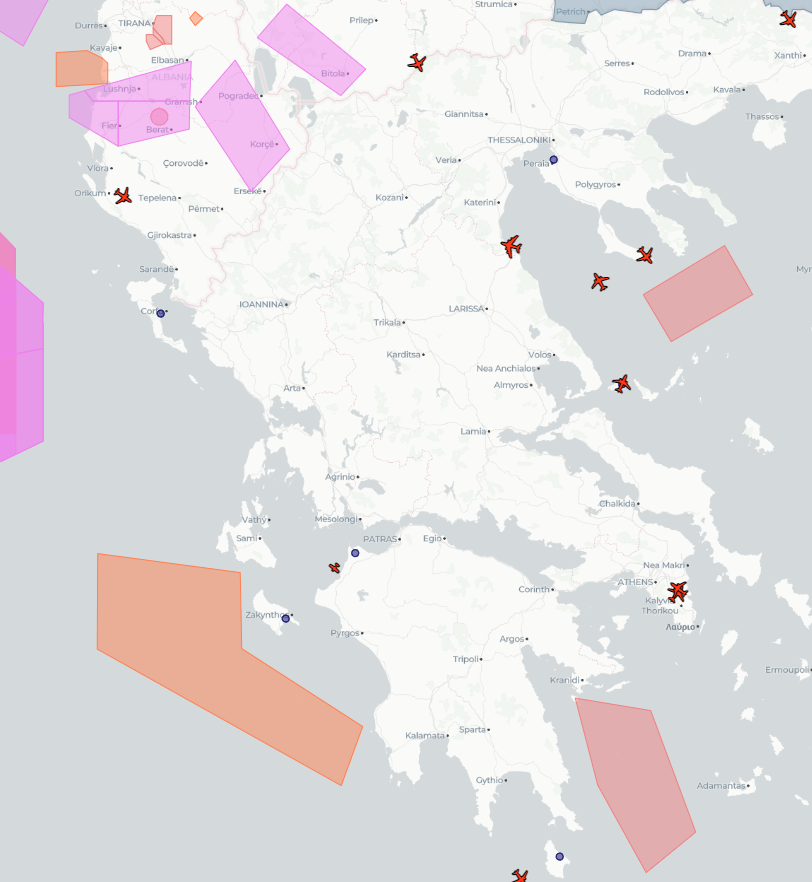  |
When you have “Display Special Areas” turned on from the options, you will see shapes in different colors.
Here's a table of what these colors mean:
|
Area Type |
Color |
|
R (Restricted) P (Prohibited) |
Red |
|
D (Danger) |
Orange |
|
TRA (Temporary Reserved Area) TSA (Temporary Segregated Area) |
Pink |
- You can also click on each area to get details about it.
¶ NOTAM Display on Map
|
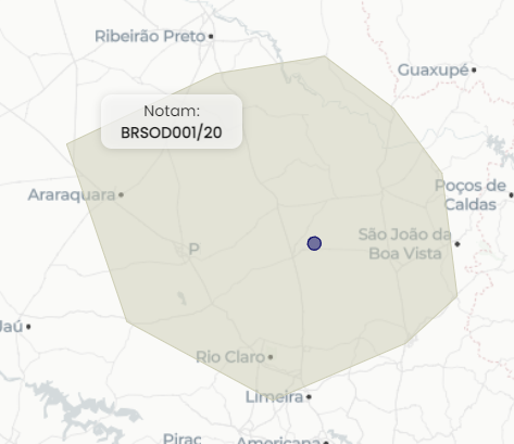
When you have the “Display Notams” turned on from the options, you will see shapes in light green.
- You can also click on each area to get details about it.
¶ NOTAM Display on Airport
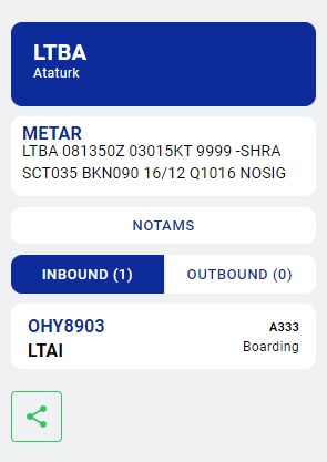
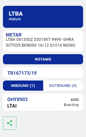
When you click on an airport, if there are any Notams available, there will be an extra button to display them.
 |
 |
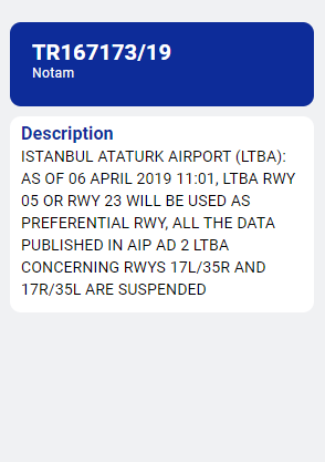 |
- On this screen, you can see all the Notams available for the Airport and click on them to see details.
¶ Aircraft Representation
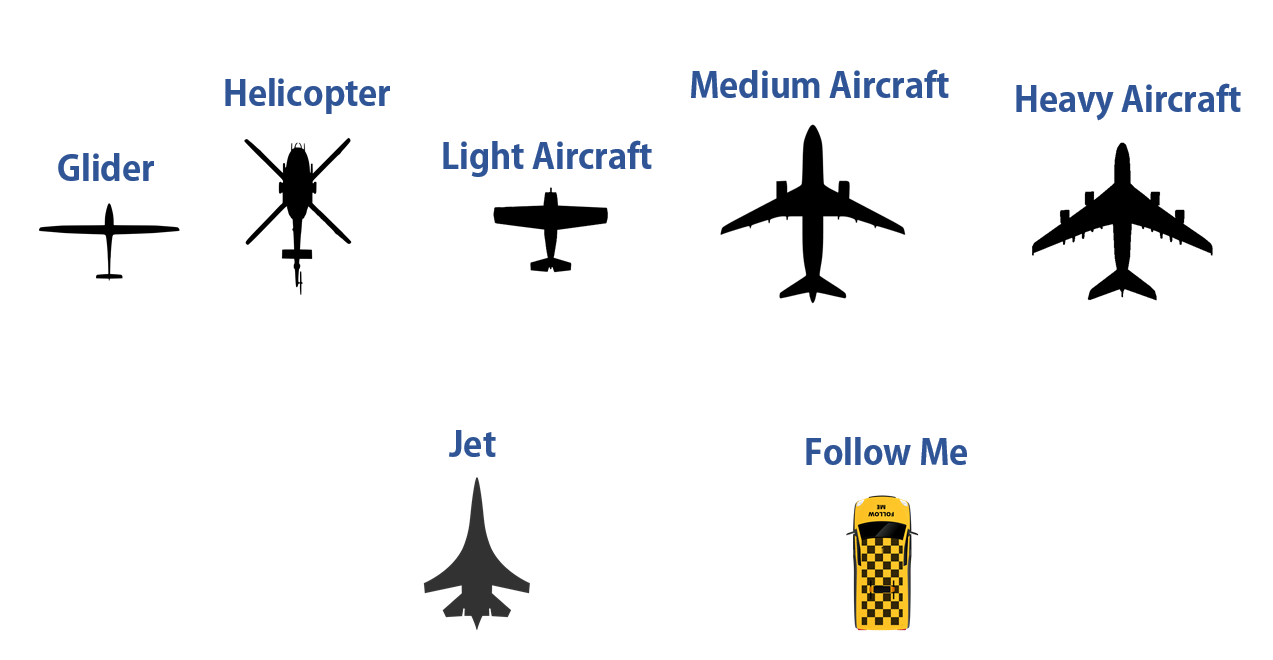
Each aircraft connected and flying on the IVAO network is represented by one of the icons presented below:
¶ Pilot List
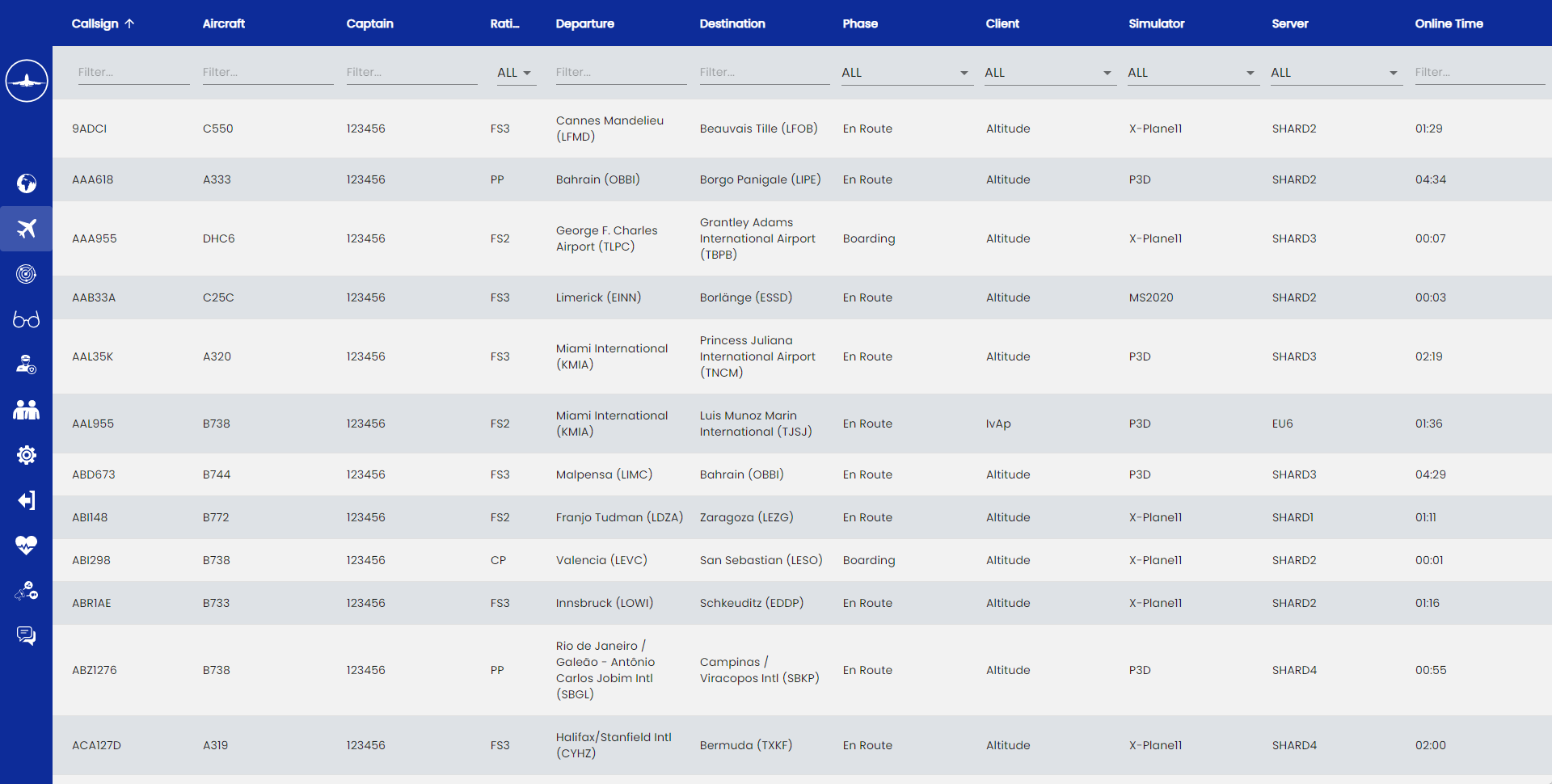
You can display the Pilot list and the Webeye will present the information like the figure below: On this list, you can filter users using the search boxes.
¶ ATC List
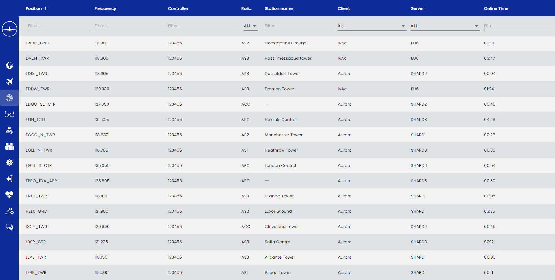
You can display the ATC list and the Webeye will present the information like the figure below: On this list, you can filter users using the search boxes.
¶ Observer List
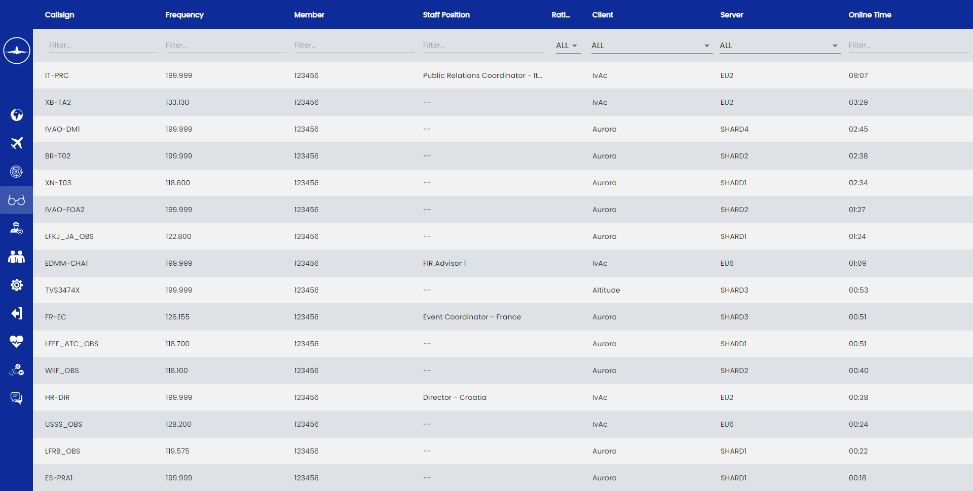
You can display the Observer list and the Webeye will present the information like the figure below: On this list, you can filter users using the search boxes.
The observers are all members (regular, staff members) connected to look at the current activity on the network. The observers are neither active controllers nor active pilots.
¶ Supervisor List
Supervisors are IVAO members connected as observers, pilots and ATC who are responsible for helping the members and resolving issues on networks (except those network structure related).
¶ Friend List
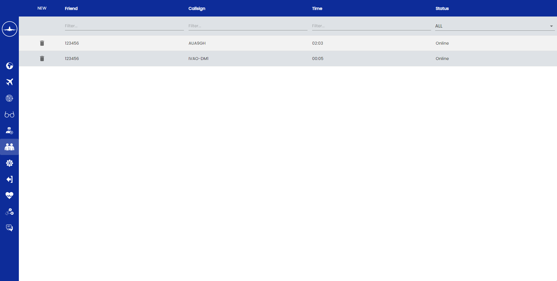
Once logged in, you can add members as friends. To add a friend, click on NEW then enter his/her VID on the field. Click on pilot /ATC callsign to display its aircraft/position on the map. Click on his VID to display his IVAO Profile
Click on pilot/ATC callsign to display it is aircraft/position on the map. Click on his VID to display his IVAO profile.
¶ Webeye Use
¶ Webeye use for Controllers
Keep in mind that Webeye is not necessary for a controller to use, as out radar software gives more information.
But, Webeye can be used to:
- verify your wanted position is active or not in the network before connection
- verify the nearby air traffic controller before connection
- verify the incoming aircraft to your airport(s) which are very far from your area of responsibility
Webeye is not a tool that helps you to provide ATC traffic service!
¶ Webeye use for Pilots
Keep in mind that using Webeye is not necessary to fly.
But it can be very helpful for pilots to check:
- Their flight progress in order to detect technical issues (your aircraft is not moving on the network)
- Their flight progress including track flied since take-off (see figure below)
- If there is nearby aircraft not communicating on UNICOM in order to get their call sign
- Active NOTAMs for airports.
- Special Areas near or on their Route.
Pay attention that this tool is monitored continuously by observers and supervisors.
Signification of the aircraft route colors:
| Minimum altitude | Maximum altitude | Color |
|---|---|---|
| 0 | 900 | Red |
| 900 | 2900 | Orange |
| 2900 | 4900 | Yellow |
| 4900 | 9900 | Light Green |
| 9900 | 14900 | Green |
| 14900 | 19900 | Cyan |
| 19900 | 24900 | Red |
| 24900 | 29900 | Light Blue |
| 29900 | 42900 | Dark Blue |
| 42900 | - | Purple |
Webeye can be used by pilots to verify presence of ATC and check:
- If their flight will enter a controlled area soon
- The ATC activity for the planned flight.
¶ Author
- VID 573229 - Wiki Migration & Updates