¶ Introduction
In front of the initial approach charts of an airfield, there is usually an aerodrome chart.
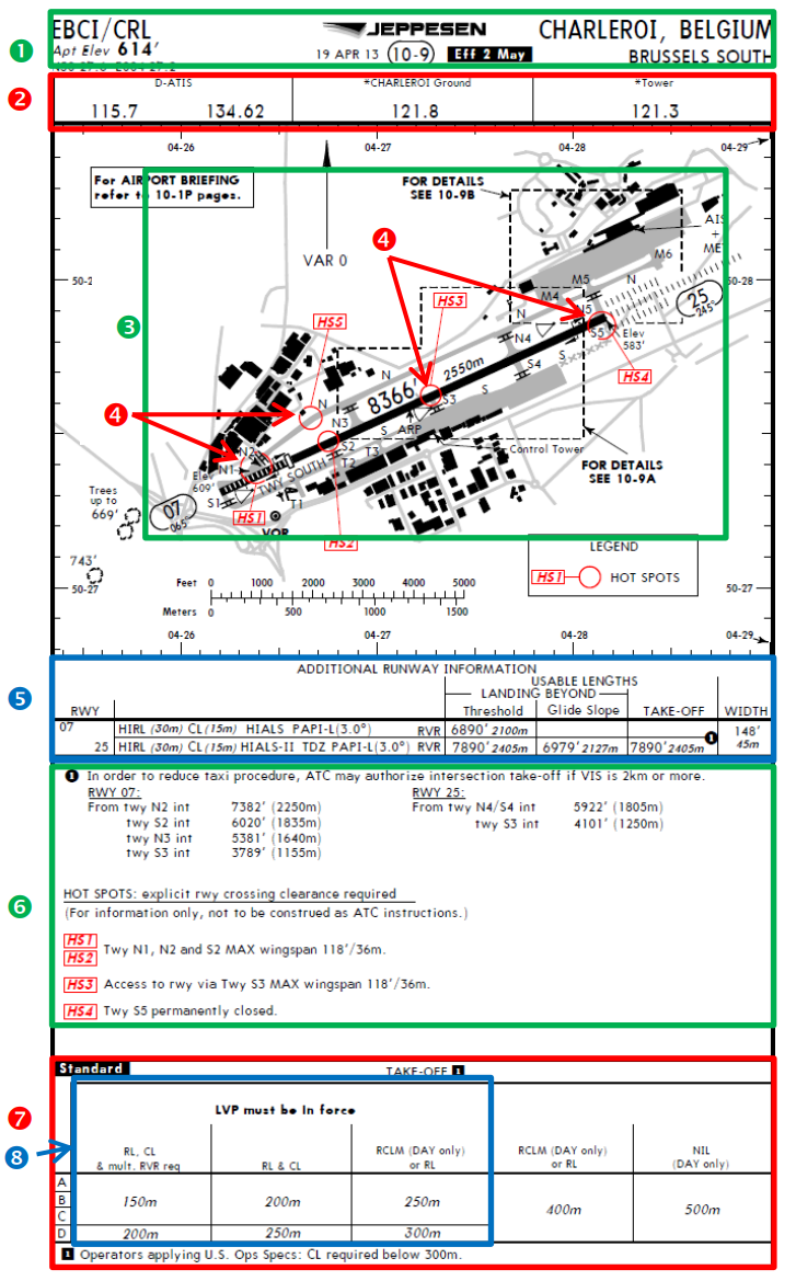
This chart generally includes:
- Frequencies to be used for ground and tower controllers and ATIS
- Airport layout (runways, taxiways, apron...)
- Additional runway information
- Take-off minima
- Additional procedure on ground or in the air.
¶ Description

- Airfield ICAO/IATA code, name, country, airport elevation altitude, date of publication
- List of available frequencies (in MHz)
- Ground layout including runway(s), taxiway(s), holding point(s), terminal and building...
- Hot spot(s) to highlight dangerous areas (in terms of collision threats on the ground)
- Additional runway information that contains:
- Runway light equipment
- Runway landing/taking-off lengths
- Runway width
- Additional information in our example:
- Taking off distance from holding points
- Hot spots information
- All other useful information
- Take-off RVR minima
- Take-off RVR minima when LVP (low visibility procedures) are in force
- ICAO documentation Annex 4 - Aeronautical Charts - 11th Edition July 2009
- VID 150259 - Creation
- VID 200696 - Wiki Integration
- VID 496402 - Wiki.js integration