¶ Introduction
This document will explain the standard instrument departure charts named SID charts. These charts are used when performing an IFR departure from the considered airfield. This document will show you some commented examples.
Be aware that each country has its own chart presentation. You need to catch your information using a quick analysis of the chart.
¶ Head of document
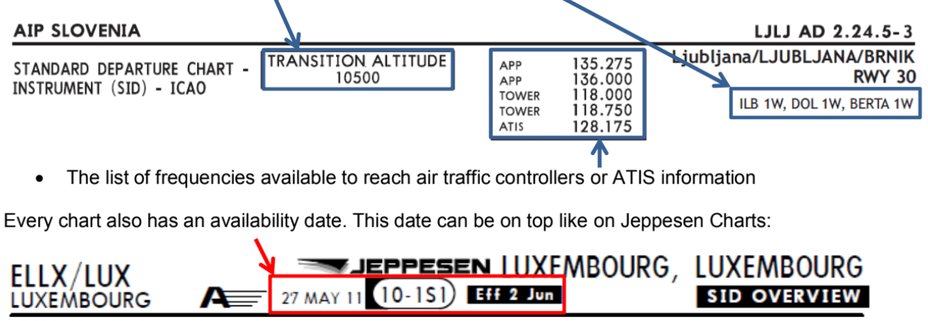
The head of document will tell you the type of chart, the name and ICAO code of the applicable airfield.

You can find also:
- The list of departure routes depicted on the chart.
- The transition altitude

¶ Procedural charts: SID route and constraints
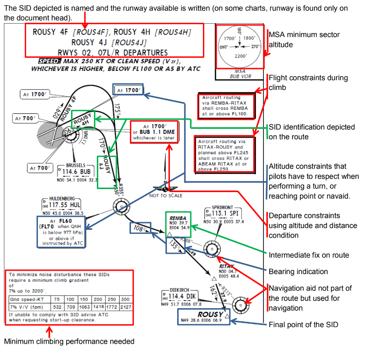
In the centre of the chart, there is the real SID route to follow.
The route to follow is depicted with black bold arrows starting from runway threshold to the first en-route point. A chart can contain one or several routes. The pilot has to select the right one to perform its flight.

¶ Charted altitude/flight level restriction
| Definition | Representation Altitude | Representation Flight Level |
|---|---|---|
| Altitude window | ߺߺߺߺߺߺߺ 17000 10000 ‾‾‾‾‾‾‾‾‾ |
ߺߺߺߺߺߺߺ FL220 FL100 ‾‾‾‾‾‾‾‾‾ |
| At or Above altitude | 5000 ‾‾‾‾‾‾‾‾ |
FL70 ‾‾‾‾‾‾‾‾ |
| At or Below altitude | ߺߺߺߺߺߺߺ 5000 |
ߺߺߺߺߺߺߺ FL200 |
| Mandatory Altitude | ߺߺߺߺߺߺߺ 3000 ‾‾‾‾‾‾‾‾‾ |
ߺߺߺߺߺߺߺ FL140 ‾‾‾‾‾‾‾‾‾ |
| Recommended procedure altitude | 4000 | FL90 |
| Expected altitude | Expect 6000 | Expect FL80 |
¶ Practical example
Hereunder, you can see the extract of the SID chart of LJLJ airport.
The air controlling unit has given to the pilot the BERTA1W departure.
We show you the elements to take into account:


- ICAO documentation Annex 4 - Aeronautical Charts - 11th Edition July 2009
- VID 150259 - Creation
- VID 256272 - Wiki Integration
- VID 496402 - Wiki.js integration