¶ Conditions for the formation and stages of development of a thunderstorm cell
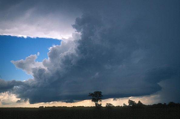
A thunderstorm is a complex atmospheric phenomenon dangerous for the formation, associated with cumulonimbus clouds and characterized by the occurrence of discharges - lightning that occurs between clouds, in a cloud or between clouds and the earth. A cumulonimbus cloud with a formidable thunderstorm is called a thundercloud.
For the formation of thunderclouds, physical conditions are necessary: a mechanism (factor) that causes the air to move upwards, unstable stratification of the atmosphere, and high humidity.
The mechanism leading to the formation of Cb clouds is thermal (forced) convection, the development of which requires unstable atmospheric stratification. If the air humidity is low, then clouds do not form. For example, if the dew point deficit is more than 20 °C in the surface layer, then the probability of the formation of thunderclouds is small.
Lightning occurs as a result of the formation of volumetric electric charges in Cb clouds due to the electrization of water droplets and ice particles. A large role in the formation of the electric field in clouds belongs to vertical movements, under the influence of which the separation of electric charges occurs so that positive charges prevail in the upper part of the cloud, and negative charges prevail in the lower part of the cloud.

Distribution of electric charges in a storm cloud
The positive charges at the top of the cloud dominate the ice particles at air temperatures below about -12°C. The negative charges at the bottom of the cloud are concentrated mainly on large water droplets. As a result, a main electric field with a strength of up to 100,000 V/m is formed.
The value of the electric field strength (of the order of 106 V/m) required for the occurrence of lightning is called the breakdown or critical value. The critical value of tension is created under the influence of turbulent exchange in the cloud.
A thundercloud differs significantly from a Cb cloud with a shower, but without a thunderstorm, and even more so from a powerful cumulus cloud.
A developing powerful cumulus cloud turns into a thundercloud, as a rule, under the following conditions:
– the thickness of the cloud becomes more than 4.5 km;
– the updraft velocity in the cloud exceeds 9 m/s;
– the temperature at the top of the cloud drops below –30 °C.
Characteristics of powerful cumulus and cumulonimbus clouds
| Cloud Characteristics | Powerful cumulus cloud | Cumulonimbus cloud with rain | Thunder cloud |
|---|---|---|---|
| Thickness, km | < 4 | 2–4 | > 4,5 |
| Speed of vertical movements, m/s | < 6 | 6–8 | > 9 |
| Temperature at the upper limit, °C | – | Above -30 | Below -30 |
| Electric field strength, V/m | 40–50 | 4000–5000 | 100 000 |
| Сloud elements | Drops | Drops, ice particles | Drops, ice particles |
¶ Types of thunderclouds
There are three types of thunderclouds: single-cell, multi-cell and supercell cumulonimbus clouds.
A single-cell cloud Cb consists of one thunderstorm cell that goes through three stages of development without the formation of an anvil. Rainfall falling from the cloud cools the air near the earth's surface and suppresses the development of updrafts, which leads to the destruction of the cell. The lifetime of a single-cell cloud is about 30 min; the horizontal size of the cloud rarely exceeds 7 km.
The multicellular cloud Cb includes several convective cells at different stages of development. Each cell goes through three stages of development, but not simultaneously with other cells. At first, the cloud appears as a single cell.
After 10–15 min, when the cloud reaches the stage of maturity, a second (daughter) cell appears at a distance of 20–30 km to the right of the general direction of cloud movement.
The emergence of new cells leads to the fact that a multi-cell cloud Cb can exist for several hours.
In a multicellular cloud Cb, the velocity of ascending air motions is maximum in its front part and averages about 20 m/s. In the rear part of the cloud, from which precipitation falls, descending air movements prevail, the maximum speed of which is noted at the base of the cloud and is about 15 m/s.
The horizontal size of a multicellular cloud can exceed 60 km. The cloud has multi-domed peaks that end in anvils located at different heights. The cloud moves in the direction of the leading flow, deviating slightly from it to the right due to the formation of new thunderstorm cells.
The supercellular cloud Cb consists of one cell and has a large vertical (up to 15 km) and horizontal (up to 60 km) extent. Sometimes the cloud diameter can exceed 60 km. The top of the supercell cloud has a single dome shape. Updrafts in the cloud can reach up to 50 m/s and more. The lifespan of a supercell cloud is about 4 hours.
¶ Thunderstorm as a complex atmospheric phenomenon
A thundercloud poses a very great danger to aircraft flights. An aircraft entering a cloud or flying near a cloud can result in a disaster due to lightning, heavy rainfall, hail, squall, tornado, microburst, severe turbulence, strong wind shear, heavy icing of the aircraft.
¶ Lightning
Lightning is linear, flat, beaded and ball.
Linear lightning is observed most often and is divided in appearance into branched, ribbon and rocket-shaped. Explosions of detonating gas, formed as a result of water decomposition, and an increase in pressure with an increase in temperature in the lightning channel are accompanied by the formation of shock waves, which are perceived by a person as thunder.
Flat lightning is a noiseless reddish glow of a part of the Cb cloud, which occurs due to a large number of corona discharges on cloud elements.
Bead lightning is observed in the form of a chain of luminous points located at a distance of about 1 m from each other and representing spherical formations with a diameter of several centimeters. The lifetime of the bead
lightning does not exceed 1 s.
Ball lightning can be short-lived and long-lived. Long-lived lightning is larger than short-lived ones.
¶ Hail
GR, Hail is the most dangerous type of precipitation for aviation that falls from thunderclouds. An aircraft can get into the hail zone not only during takeoff and landing, but also when flying at an echelon near a cloud, since hailstones can be carried out of the cloud by strong horizontal air currents. Hailstones can damage the surface of the aircraft and contribute to its depressurization.
¶ Squall
SQ, Squall - a sudden short-term (within one or several minutes) increase in the surface wind by at least 8 m/s, accompanied by a sharp change in its direction by almost 180°. Squall wind speed is 11 m/s or more and can increase up to 60 m/s.
The squall is observed in the zone of a vortex with a horizontal axis of rotation, which occurs in the front part of the Cb cloud at its base at the junction of ascending and descending air currents. In the area of the vortex, one can see the squall gate (Arcus) - a dark rotating shaft of broken clouds, which appears at a height of several hundred meters and can descend to the surface of the earth.
¶ Tornado
FC, Funnel Cloud, tornado - a vortex in the atmosphere with a vertical or slightly curved axis of rotation. Tornadoes are almost always associated with supercellular thunderclouds that form in the region of deep cyclones. The air in the area of the tornado rotates around the vertical axis almost as fast as it moves towards the axis and along it upwards. The air pressure in the center of the vortex can be 10% lower than the pressure at the periphery. This is almost the same pressure difference as between sea level and 1 km altitude.
¶ Gust front
A gust front is the leading edge of cold, dense air that, moving downward, reaches the earth's surface and spreads in all directions under the Cb cloud, displacing the warmer and less dense surrounding air.
¶ Microburst
A downburst is a strong downdraft, usually associated with a mature thunderstorm cloud, that causes destructive winds in the surface layer. In the area of the downburst, smaller but more intense downbursts are found, which are called microbursts.
A microburst is a downward airflow that causes a sudden onset of strong wind in an area with a horizontal extent of 0.4 to 4 km. A microburst includes two components: a strong downdraft and a gusty, unstable surface wind, lasts about 5 minutes and poses a great danger during landing approach, landing and takeoff of the aircraft.
¶ Cumulonimbus (Cb)

¶ Types of Cumulonimbus
Convection. Caused by heating of the layer of air close to the surface. This type of Cb commonly forms in the late afternoon after the peak diurnal heating. Thunderstorms of this type are a daily occurrence in many areas of the tropics. The storms are usually single Cb cells rather than clusters of cells and so can generally be avoided by flying around them.
Orographic Uplift. Caused by rising ground forcing the air upwards (Orographic Lift). These storms form when a general flow of moist unstable air passes over higher terrain, such as a ridge line or mountain range. Such storms often form in a line along the ground feature and are therefore more challenging to avoid than single cells.
Mass Ascent. Caused when a weather front forces the air upwards. As with orographic lift, the Cb cells form in a line along the front, frequently embedded within wider frontal cloud, therefore presenting a challenge to aircraft trying to navigate through the front.
¶ Effects
Turbulence. Vertical movement within a Cb can be as much as 50kt. The interaction between strong updrafts and strong downdrafts causes wind shear and severe turbulence within the cloud. Strong surface winds, variable in direction and strength, are common at surface level in the vicinity of the Cb. These can be particularly hazardous to aircraft on take-off or landing.
In-Flight Icing. Moderate to Severe icing can be expected, especially in the higher levels of the cloud.
Electrical disturbance. Aircraft flying in the vicinity of Cb clouds may experience electrical disturbances effecting communications and navigation systems. The electrical phenomenon known as St Elmo's Fire, while not a threat to safe flight, is an indication of nearby Cb activity. Aircraft in the vicinity of a Cb are at risk of being hit by Lightning.
Precipitation. Hail can cause significant structural damage to an aircraft. Other precipitation, such as snow, sleet, or rain, can contaminate airfield and runway surfaces creating a hazard to aircraft attempting to take-off or land.
Extreme weather. Severe downdrafts, microbursts and funnel clouds such as Tornados are also features of cumulonimbus clouds.

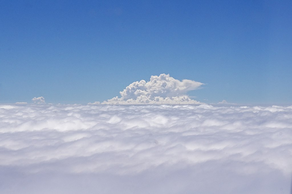
Top of Cb cloud breaking through layer cloud.
¶ Towering Cumulus (TCU)
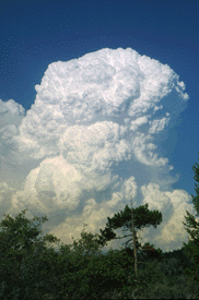
When the top of the cumulus resembles the head of a cauliflower, it is called cumulus congestus or towering cumulus. These clouds grow upward, and they can develop into a giant cumulonimbus, which is a thunderstorm cloud.

AERONAUTICAL METEOROLOGY T. V. Safonova
https://www.skybrary.aero/articles/cumulonimbus-cb
https://eo.ucar.edu/webweather/cumulus.html#:~:text=When the top of the,which is a thunderstorm cloud.
VID 582348 - Creation