¶ Introduction
Airborne weather radar is a type of radar used to provide an indication to pilots of the intensity of convective weather. Modern weather radars are mostly doppler radars, capable of detecting the motion of rain droplets in addition to intensity of the precipitation.
¶ How to use the Weather Radar
Weather Radar displays are not available.
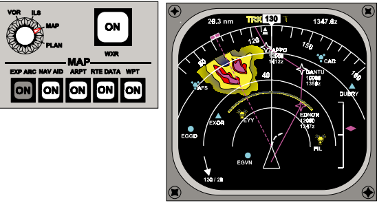
Weather Radar displays are available, when selected on range arcs are also visible. Weather Radar shows three colours green, yellow and red.
Green being the least turbulence.
Red being the worst turbulence.
If turbulence mode is available it is shown as magenta, the area of greatest activity
in the cloud.
The range of the display can be selected on the control panel, half scale range is
displayed (10 Nm) so this display is selected to 20 Nm. The outer arc of the compass rose is the furthest range from the aircraft.

The mode used normally is the MAP display, which, in conjunction with the flight plan data programmed into a flight management computer, displays information against a moving map background with all elements to a common scale.
At the top of the display Weather Radar (WXR) return data and range arcs are displayed when the WXR switch is on. Turbulence mode (+T) may be available

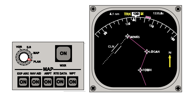
In Plan mode a static map background is used with active route data orientated to true
north.
Weather Radar display data is inhibited.
¶ Failure Annunciation
Fault messages may be displayed, for example if the associated flight
management computer and weather radar range disagree with the control panel range data, the discrepancy message WXR/MAP RANGE DISAGREE appears on the EHSI.
- None
- None
- VID 489972 - Creation