¶ INTRODUCTION
There are several ways to indicate the vertical position of aircraft and/or obstacles.
Each of them has a different meaning and is used in a particular situation:
- height
- altitude
- flight level
¶ UNITS
¶ UNITS FOR VERTICAL POSITION
In general, vertical positions are expressed in FEET (ft).
In some parts of the World, vertical positions can be expressed in METERS (m).
Note: China uses meters in their airspace. The Russian Federation uses meters below Transition Altitude.
The unit ‘feet’ (ft) is sometimes abbreviated by the sign ' (example: 1000' = 1000 ft).
¶ UNITS FOR PRESSURE
Depending on the aircraft equipment, the pressure altimeter will only accept a sub-setting:
- in hecto Pascal (hPa)
- in Inches of Mercury (in Hg).
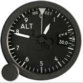
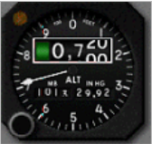
Most altimeters in hPa do not show decimals. In that case, select the nearest value. If not able to select 1013,25 then, select 1013 hPa. Some pressure altimeters show a millibar (mB) setting instead of hPa. This is not a problem since 1 mB = 1 hPa.
¶ HEIGHT AND QFE
The HEIGHT is the vertical distance of an aircraft above whatever SURFACE (buildings, mountains, a lake, etc.).
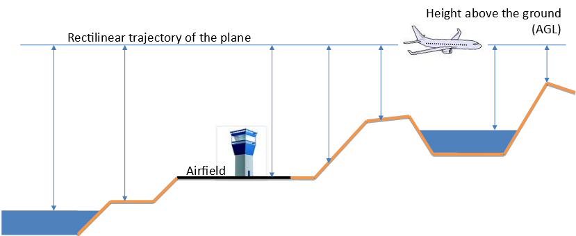
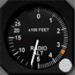
A radio-altimeter indicates the HEIGHT above whatever you are flying at that moment, not just the airport!
QFE is the atmospheric pressure at a specified datum such as an airfield runway threshold.
When set, the altimeter reads the height above the specified datum.
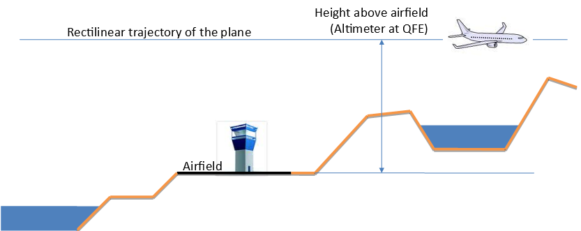
HEIGHT is expressed in feet AGL (Above Ground Level) or meters in some countries.
By setting the QFE value of an airport, the altimeter will show, all the time, the HEIGHT above that airfield. On the ground at the airfield, the altimeter will show 0 ft (zero). The higher the airport elevation is, the lower is the QFE.
Disadvantages:
Because an airfield is often located lower or higher than the surrounding airfields, the QFE for each airfield will be quite different, even if they are a few miles apart.
Each time a pilot flies over another airfield, he has to change his altimeter sub-setting to the QFE of that airfield - not a very practical solution!
Be careful, QFE is never used to separate aircraft vertically!
¶ ALTITUDE, QNH AND ELEVATION
ALTITUDE (ALT) is the vertical distance of an aircraft above the MEAN SEA LEVEL (MSL).
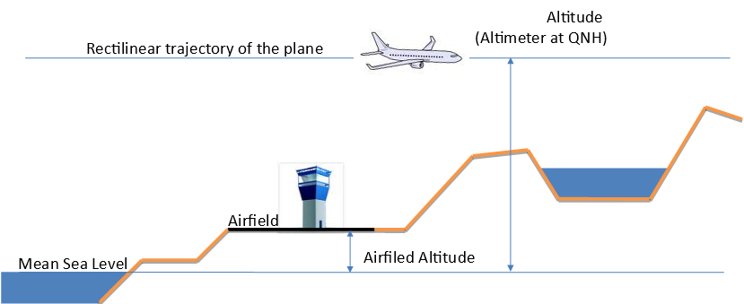
For objects and obstacles on the surface of the earth, the word ELEVATION (ELEV) is used instead of altitude.
QNH is the atmospheric pressure at mean sea level (may be either a local, measured pressure or a regional forecast pressure (RPS)). When set on the altimeter it reads altitude.
ALTITUDES and ELEVATIONS are expressed in feet AMSL (Above Mean Sea Level) or meters in some countries.
When an airfield QNH value is set on the aircraft's pressure altimeter, this altimeter shows ALTITUDE.

On the ground at an airport, the altimeter will (approximately) show that airfield altitude or elevation, when the aerodrome QNH is set on the aircraft's altimeter.
Commonly, the QNH altimeter setting is used worldwide at or below the transition altitude (TA) or below 3000ft AGL.
¶ FLIGHT LEVEL AND STANDARD PRESSURE
A Flight Level (FL) is the vertical distance of an aircraft above the ISOBARIC SURFACE of 1013.25hPa (hecto Pascal) or 29.92 in Hg (inches of Mercury).
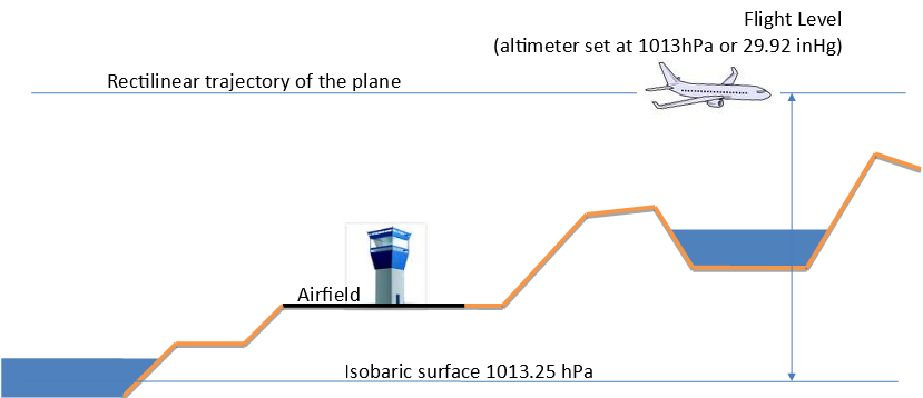
An ISOBARIC SURFACE is the invisible landscape that connects all points with the same atmospheric pressure. In aviation, 1013.25hPa (hector Pascal) / 29.92 in Hg (inches of Mercury) are referred to as the STANDARD altimeter setting.
The Flight Level is written using the two letters FL with the altitude (at standard QNH) in feet, without the two digits at the end:
- 10000 feet becomes Flight Level 100 = FL100
- 6500 feet becomes Flight Level 65 = FL65
Commonly, the standard altimeter setting is used worldwide at or above the transition level (TL).
¶ ISOBARIC SURFACE CURVE
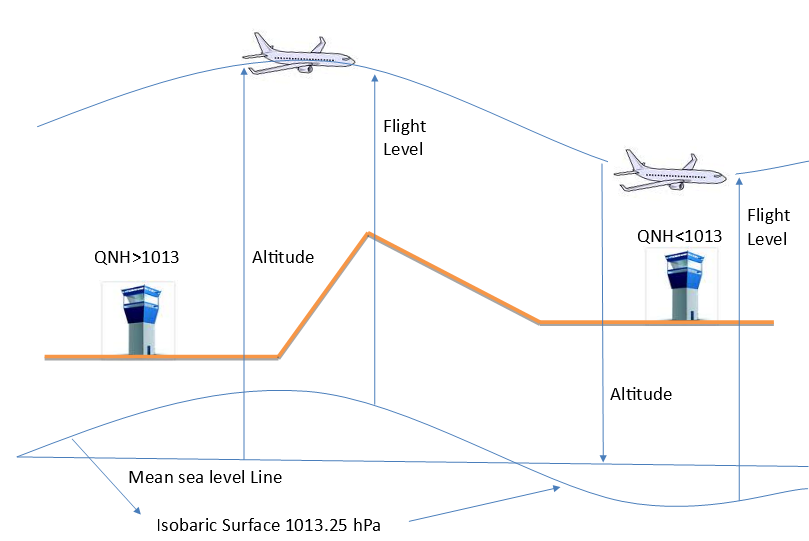
Because of differences in location, different airfields have different QNH values. Then, the 1013.25hPa isobaric surface is a fictive curve which can be greater or lower than the mean sea level fictive surface.
When maintaining a flight level, all aircraft have the same reference in order to maintain separation between them with that same reference, but you must know that the aircraft altitude (when following a flight level) changes slowly in conjunction with the local QNH.
¶ SEE ALSO
- Transition altitude and transition flight level, Altimeter, Altimeter setting methodology
¶ REFERENCE
- none
¶ AUTHOR
- VID 150259 - Creation
- VID 150259 - Wiki integration
- VID 545587 - Wiki migration